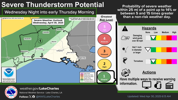
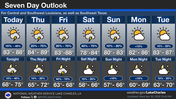
Lake Charles, Louisiana - Residents of Southeast Texas and Southwest Louisiana are advised to exercise caution on Wednesday as a cold front approaches the area, bringing with it a marginal risk of flash flooding and severe thunderstorms.
According to forecast conditions, scattered showers and thunderstorms are expected to develop along and ahead of the cold front, with some storms capable of producing heavy rainfall. A marginal risk of flash flooding exists, with a 5% chance of flash flooding occurring within a 25-mile radius of any location across the region.
Flash flooding occurs when heavy rainfall overwhelms the capacity of the drainage system, causing rapid rises in water levels. This can lead to hazardous conditions, particularly for drivers. Residents are advised to avoid flooded roadways when traveling, as driving through floodwaters can be deadly.
In the event of a vehicle becoming stalled in floodwaters, drivers are urged to abandon their vehicle and seek higher ground. Low-lying areas near bayous, creeks, rivers, and streams are particularly susceptible to flooding, especially if repeated or training thunderstorms occur.
In addition to the risk of flash flooding, there is also a marginal risk of severe thunderstorms containing damaging wind gusts and tornadoes. These storms are expected to develop on Wednesday afternoon and continue into the evening.
While the chance of damaging wind gusts and brief tornadoes is low, residents are advised to seek shelter if a severe thunderstorm warning is issued for their area. A severe thunderstorm warning is issued by the National Weather Service when a storm is capable of producing winds of at least 58 miles per hour, hail of at least one inch in diameter, or a tornado.