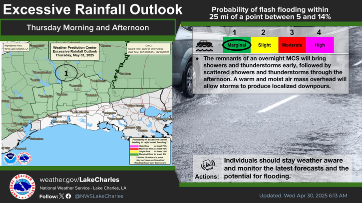
Louisiana - Southern Louisiana and Southeast Texas are expecting significant weather changes as a low-pressure system strengthens along the coast. Residents can expect heavy rainfall and gusty winds beginning Thursday night and continuing into Friday morning.
Meteorologists warn that areas south of Interstate 10 will be particularly vulnerable to intense rainfall, with the potential for localized flash flooding. Rain showers, some heavy, are predicted to produce intense rainfall over short periods. This could lead to flooding in low-lying areas and regions with poor drainage.
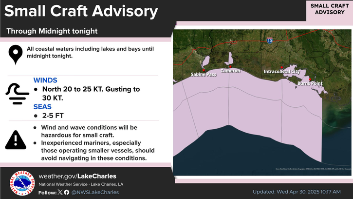
In addition to the rain, a Wind Advisory is in effect from Thursday afternoon through Friday morning. The advisory commenced at 3 PM Thursday for coastal areas near the Gulf of Mexico, with northeast winds expected to range from 15 to 25 miles per hour. Gusts could reach up to 45 miles per hour, which is strong enough to move unsecured objects and potentially break tree limbs.
As the evening progresses, the winds will shift to the east and northeast, maintaining the same speed but with gusts potentially reaching 40 miles per hour. This increase in wind and rain activity is expected to spread eastward from 6 PM Thursday until 6 AM Friday.
Offshore conditions will be particularly hazardous, with wind speeds ranging between 50 and 60 miles per hour. This poses a risk for mariners and those engaged in maritime activities, emphasizing the need for caution.
Residents should prepare for possible power outages due to the wind.
The combination of excessive rainfall and strong winds signifies a challenging weather pattern for the affected regions.