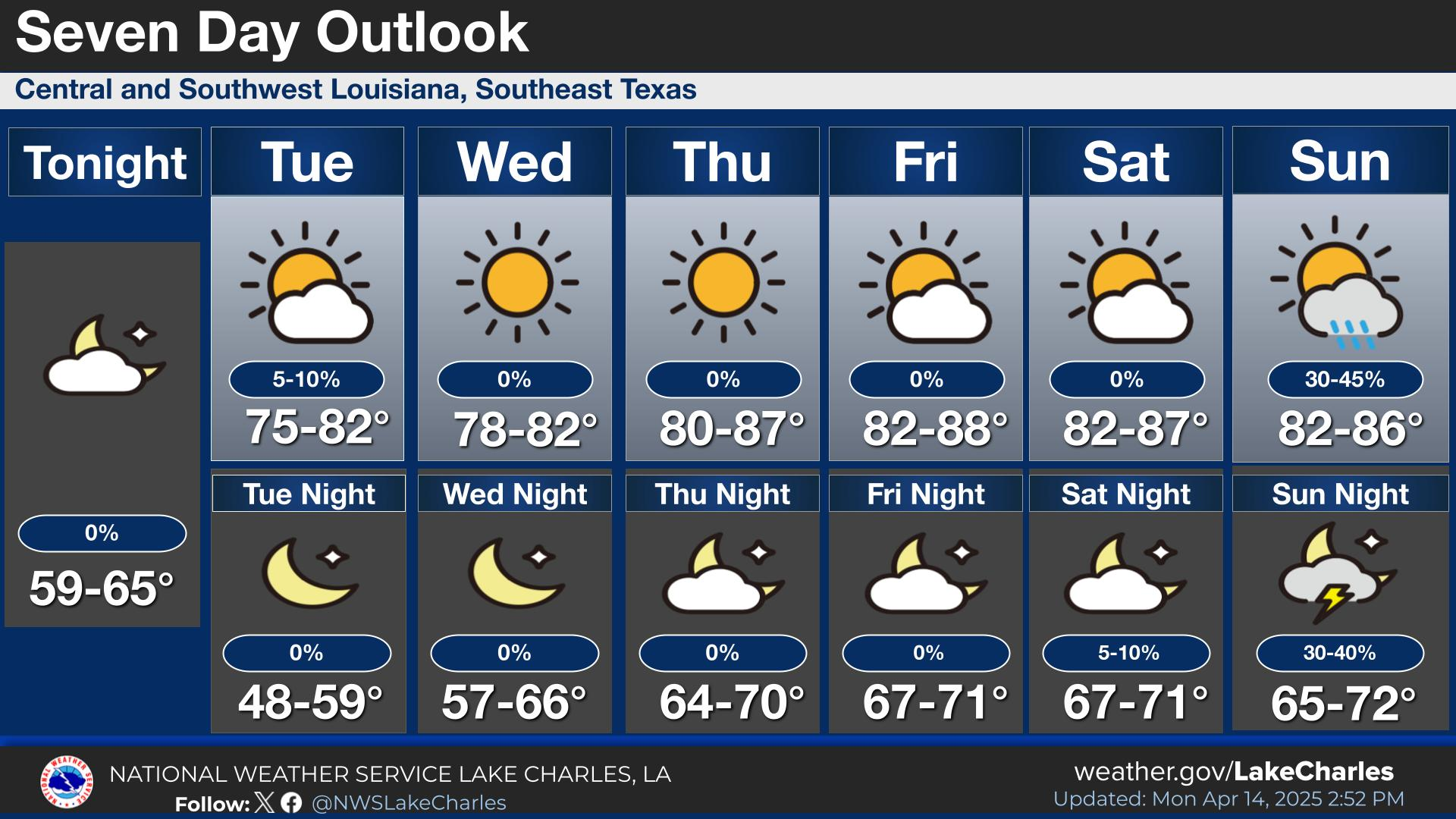
Lake Charles, Louisiana — The National Weather Service has issued a flood watch for all of Louisiana, warning residents to prepare for multiple days of heavy rain and potential flash flooding from Tuesday through Thursday evening. Meteorologists are closely monitoring a slow-moving storm system forecast to bring widespread rainfall totals of 3 to 8 inches, with isolated areas potentially seeing up to 12 inches.
Severe Weather and Flash Flood Risks
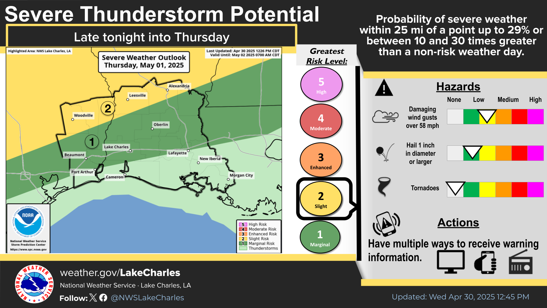
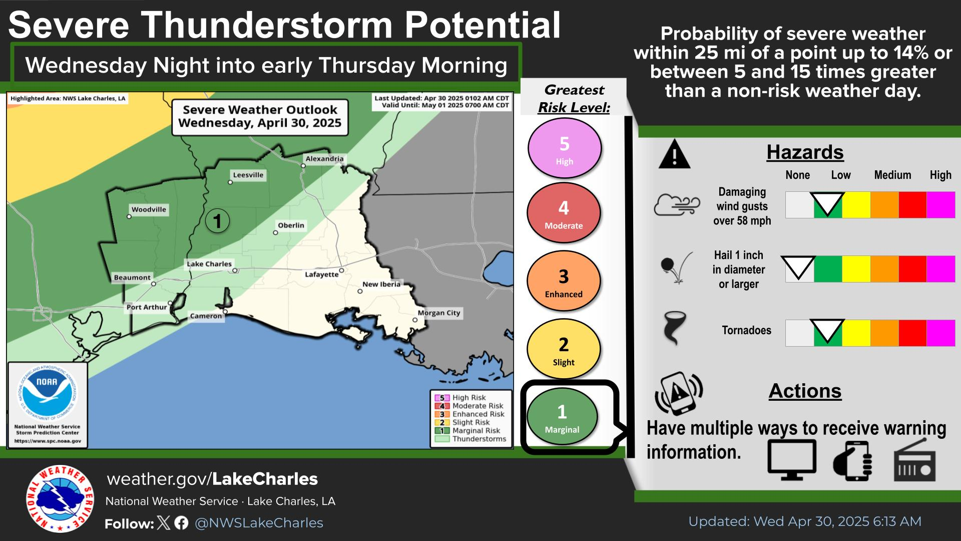
The week ahead promises active and hazardous weather across the state. The first significant round of storms is expected to impact North Louisiana during the day on Tuesday before shifting southward into Tuesday night. These storms are likely to organize into squall lines—long bands of intense thunderstorms. Along these lines, damaging winds and the possibility of tornadoes cannot be ruled out.
However, the more significant concern is the risk of excessive rainfall. When these squall lines slow down or stall, rain can fall heavily over the same areas for extended periods. This phenomenon, known as “training storms,” increases the risk of flash flooding, as the ground becomes saturated and drainage systems struggle to keep up.
Flood Watch Details
- When: Tuesday afternoon through Thursday evening
- Where: Entire state of Louisiana
- Expected Rainfall: 3 to 8 inches widespread, up to 12 inches in isolated spots
- Primary Cause: Slow-moving clusters of thunderstorms producing high rainfall rates
- Impact: Elevated risk of flooding due to already saturated ground, especially in areas with poor drainage or a history of flooding
Lake Charles and Southwest Louisiana Particularly at Risk
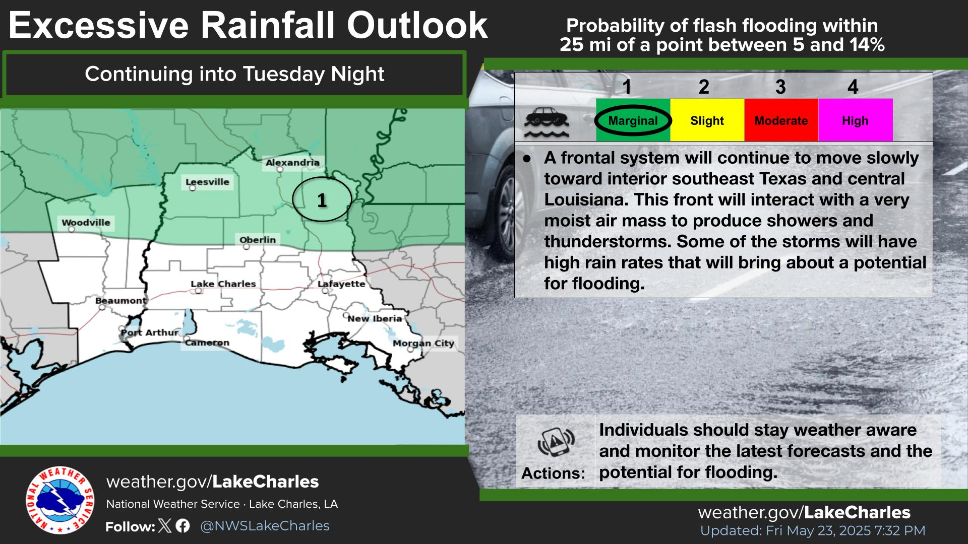
The Lake Charles area and much of Southwest Louisiana, including Calcasieu Parish, are forecast to receive 6 to 10 inches of rain. According to the National Weather Service, these areas fall within a 40% to 69% risk zone for rapid onset flooding between Tuesday and Tuesday night.
This risk means a moderate to high chance of flash flooding within 25 miles of any spot in the region. With “training storms” possible, the chance for quick and dangerous flooding increases, potentially overwhelming drainage systems and making travel hazardous. Residents should be especially cautious in low-lying neighborhoods and locations known for past flooding.
Preparedness and Safety Reminders
Those in flood-prone areas should make plans to protect property and be ready to move to higher ground if necessary. It is also advisable to avoid driving through flooded roadways, as even a small amount of moving water can be dangerous.
Travel disruptions and infrastructure impacts are likely, especially as rain continues for an extended period. Emergency management officials recommend checking for school closures and road conditions.
Outlook
The threat of heavy rain and flooding will persist into Thursday evening. Meteorologists note that while the severe weather risk is currently slight for Tuesday, the primary hazard will be flash flooding due to prolonged, intense rainfall.
Louisiana residents are encouraged to remain vigilant and take the necessary precautions to stay safe during this period of active weather. While the forecast does not call for panic, a little preparation now could go a long way in protecting lives and property.