Louisiana - Confidence is increasing that an arctic air mass will begin to affect weather conditions in Louisiana starting this Sunday. The cold front is expected to bring extremely low temperatures and dangerous wind chills from Monday, January 20, through Thursday, January 23.
Meteorologists warn of hard freeze temperatures during this period, with the potential for subfreezing conditions across the region. While the arrival of the cold air mass is certain, there remains some uncertainty regarding winter precipitation. Experts are monitoring a complex weather system that may lead to the formation of a Gulf low, which could bring moisture into the cold air. However, the specifics regarding the amount of moisture and how it will interact with the cold temperatures are still unclear.
The National Weather Service has advised that it is still too early to determine the exact impacts of winter precipitation on the area. As forecasts continue to evolve, citizens are encouraged to remain informed about weather updates, especially concerning the possibility of hazardous conditions.
In past experiences, forecasts regarding winter precipitation tend to become more reliable within 48 hours of the event. Therefore, residents are advised to stay updated on weather reports as the situation develops.
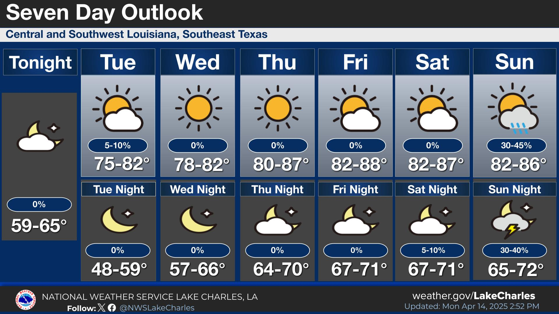
Before the arctic air descends, Louisiana will experience a brief period of milder weather. Light rain showers are expected to pass through the area today and tonight, with cooler temperatures. A warm front will move into the region on Friday, bringing an increase in temperature along with some showers into Friday night. However, this temporary respite will be short-lived, as a cold front marking the arrival of the arctic air mass will sweep through on Saturday, likely accompanied by rain showers.
As the weather pattern shifts early next week, the expected arrival of the arctic air mass will lead to much lower temperatures than the region typically experiences. Residents should prepare for the potential impacts of these cold temperatures, including the risk of frost and icy conditions.