Excessive Rainfall Outlook and Hazardous Weather Outlook for Louisiana August 27

Published August 27, 2022
Excessive Rainfall and Hazardous Weather Outlook for Louisiana August 27
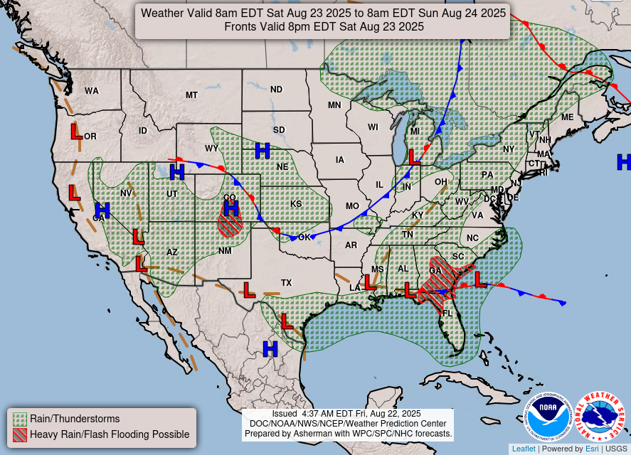
Louisiana - Scattered to numerous thunderstorms are expected each day through early next week. Locally higher winds and seas along with occasional to frequent cloud-to-water lightning and heavy rainfall can be expected with the storms.
Late on August 26, 2022, the National Weather Service reported that on August 27, 2022, a Slight Risk area remains from the Golden Triangle of Southeast Texas across Louisiana into Southwest Mississippi. Deep moisture remains in place with precipitable water values near 2" around in the region.
A deep layered circulation/frontal wave and its related surface boundary have been the focus for convection. While the activity is expected to fade closer to the circulation in Louisiana and Mississippi, it could ramp back up overnight regionally. Hourly rain totals of 2.5" with local amounts of 4" remain possible.

Tuesday, November 3, 2026 — Southwest Louisiana Daily Brief: Election Day, late storms
Polls are open today from 6 a.m. to 8 p.m., and a cold front is expected to bring showers and thunderstorms later in the day, with the strongest storms and heaviest rain most likely late in the afternoon and into the evening. 1. Calcasieu Parish — What changed today...
Tuesday, October 20, 2026 — SWLA Daily Brief: Early voting opens
Early voting opens today at four Calcasieu Parish sites and runs through Tuesday, Oct. 27. The People of Hope Museum closes out its Lake Charles stop today, and the parishwide burn ban remains in effect. Coverage window: Monday, Oct. 19, 2026, plus today's calendar...
SWLA Week Ahead: Oct. 19–25, 2026
Early voting opens Tuesday. The Great Pumpkin Trail runs all week at Tuten Park. Saturday packs in LCFD Family Day, a workshop with Dr. Ralph Martin, and the SPAR Boo Bash — and Sunday closes the week with the CalcaChew Festival. Calcasieu Parish Early voting starts...